data collection
Understanding your needs through research.
Data collection is a very important part of managing the health and quality of your pond or lake. Your waterway may be overrun with invasive aquatic plant life, or lacking fishing opportunities. You may be concerned with sediment levels and need to plan for dredging. A pollution source may need to be identified. Or you may need a map depicting the bottom contours or overall size and water volume of your pond. Whatever your concerns may be, we have the tools and the knowledge to provide you with answers.
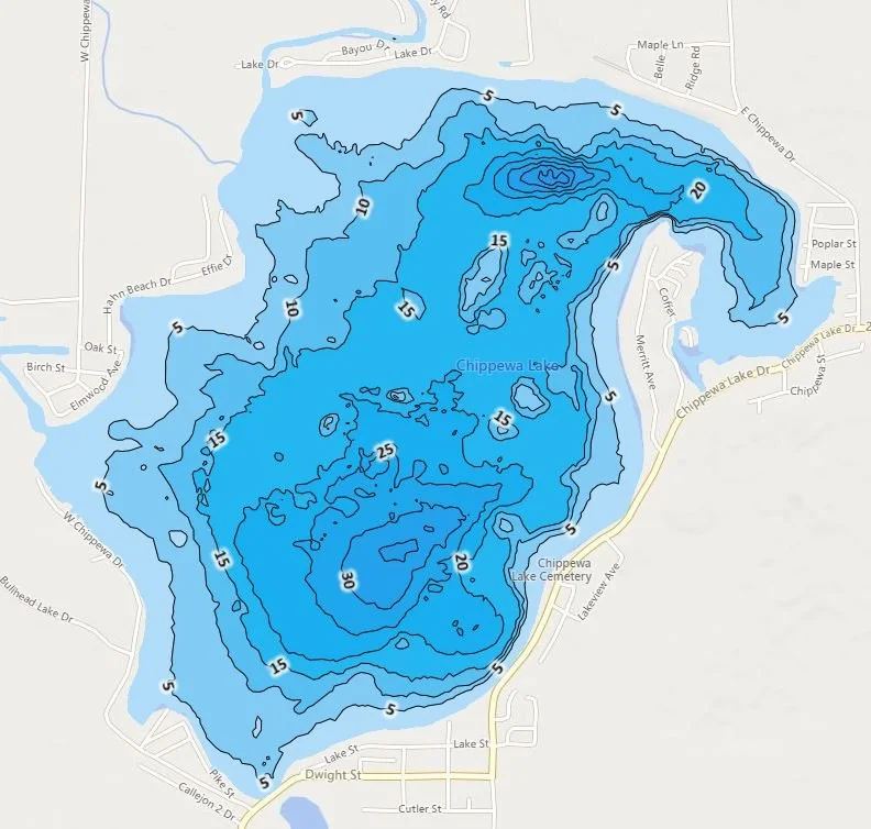
Bathymetric reports and contour mapping
Water depth and volume measurements
Surface area mapping
Aquatic plant vegetation mapping
Sediment analysis and dredging planning
Aeration device placement
collecting data to provide solutions.
SONAR TECHNOLOGY
Sonar Technology is used to capture data through sound waves that bounce back from the bottom of the pond or lake. We then analyze the data to create various reports, including detailed bathymetric profiles, submerged aquatic vegetation maps, and bottom composition charts. Vital information that will help lead our maintenance recommendations. Since waterways change over time, starting with a baseline reading allows us to track how the habitat changes from year-to-year.
MapPing
Bathymetric Maps provide a three-dimensional depiction of the contours at the bottom of your pond or lake, down to a 1-foot level of detail. Think of it like a topographical map depicting the hills and valleys of a particular piece of land. Contour mapping is an essential tool we use to better understand the overall health of your waterway and how that relates to any issues you may be experiencing. For example, an abundance of invasive plant life or a reduction in fish levels.
GPS Surface Mapping utilizes the latest satellite imagery to obtain detailed maps of floating or near-surface aquatic vegetation. This information provides us with the full picture in regard to invasive aquatic plant life that may be impinging on the health and beauty of your waterway.
Aerial Drone Technology
Aerial Drone Technology provides high-resolution video and photography of your pond or lake. The images can be used to determine the exact surface area of your waterway. They can also be used to help identify the various components of your pond or lake, such as inlet and outlet structures, possible pollution sources, aquatic plants and fish habitat, and any aeration devices. The aerial images can be used to monitor aquatic growth over time, providing before and after depictions of the effects of our maintenance programs.


